George E. Batchelder gave Batchelder Park as a gift to Amesbury for use as a public park. In 1925, it was dedicated as Victoria Batchelder Park in honor of his wife.


Once the interactive map opens, click the ➤ button to locate yourself.

Overview
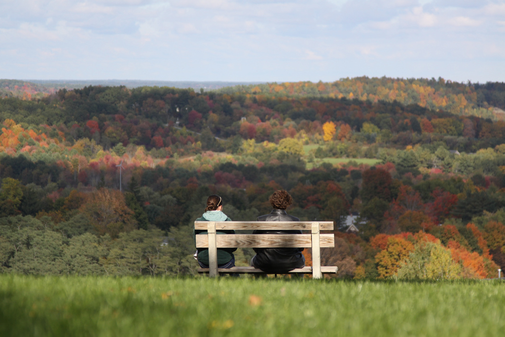
Consisting of most of the eastern shore of Lake Gardner, Powow Hill Conservation Area offers miles of well-maintained trails, complete with boardwalks and classic wood signs. From the grassy summit (Batchelder Park) a clear day can bring views of Maine's high peaks, the Isles of Shoals in the Gulf of Maine, and beyond to the open ocean. Battis Farm to the north provides open fields and secluded swimming holes. Whether you're looking for a long wooded walk or simply a place to sit and relax, Po Hill offers it all.

The kiosk at Batchelder Park shows an annotated panorama of the view.
Batchelder Park
Batchelder is a beautiful, grassy park on the top of Powow Hill. The entrance to Batchelder Park is at the end of Powow Street and can be reached from Amesbury center by following Powow Street all the way to the top. Parking for a few cars is available only a hundred yards from the summit at the top of Powow Street, or hike up the trails from Battis Farm or the public beach at Lake Gardner. Bring your morning coffee and watch Amesbury wake and bustle below as the sun rises from over the ocean.
Linked with Trails
The Powow River Conservation Area is adjacent to many other open spaces, including Lake Gardner to the west, with its swimming area to the south, Battis Farm to the north, and the Amesbury Elementary School open space to the east. In 2007, Lake Gardner Improvement Association completed an improved trail network. It continues to be maintained by volunteers. Some trails are steep and not suitable for all uses. Motorized vehicles are prohibited on all trails and boardwalks are for pedestrian use only.
A nature trail leaves the park and crosses the former ski slope, ending at the AES playground.
NOTE: The AES trail is closed to the public during school hours as it leads to the school playground.
Access
The Po Hill trails can be accessed in many ways. Here are some:
Park at Lake Gardner beach, and walk to the right, down the access road. Enter the trail system at the boardwalk.
Parking spots are available for Batchelder Park (the summit of Powow Hill) at the end of Powow St. From there, enter one of many trails starting at the edges of the grassy area.
Park at Battis Farm and follow the signs to enter the Stagecoach Trail.
When school is not in session, follow the nature trail from the AES playground. (Look for the stairs up the hill.) Trail closed to the public during school hours.
FAQ:
Q: Powow Hill or Po Hill?
A: Po Hill is what many locals call Powow Hill.
Q: How high is Powow Hill? Is it the highest hill in Essex County?
A: Powow Hill rises 332 feet above sea level, making it the highest hill in Amesbury but only the 11th highest hill in Essex County. The title of highest hill in the county goes to Holt Hill (428') in Andover. The 2nd highest point in Amesbury is Ring Hill (265'). The 3rd highest is Whittier Hill (256') (The hill on the opposite side of Lake Gardner from Powow Hill.)
More on Essex County's hills.
Q: Can you really see the Atlantic from the top of Powow Hill?
A: Yes! Check it out on a clear day.
Coming soon:
Kayak/Canoe Guide
Po Hill Nature Guide
AES Nature Trail Guide


